Wednesday, May 30, 2012
May 24-26, 2012 - New York City, NY
This time of year, with warm breezes and still-cold waters in the North Atlantic, fog is common. And it was a common morning at West Bank Light, in the Lower Bay of New York Harbor.
The Narrows separates New York Harbor’s Lower and Upper Bays, and is spanned by the Verazzano Narrows Bridge.
Often when we enter a town, they celebrate. Manhattan is no different, with Fleet Week commencing. This week-long celebration honors the women and men of the United States Armed Forces, offers tours of military ships visiting New York Harbor…..
.... and features the only international Tall Ships in Manhattan (from Colombia and Ecuador). This year's Fleet Week also marked the bicentennial of the War of 1812.
In spite of the fog, haze and then rain, the harbor is busy with traffic, including the iconic orange Staten Island Ferries, bringing workers to and from Manhattan.
And the Statue of Liberty is impressive, come rain or come shine!
The Statue of Liberty Enlightening the World was a gift from the people of France, and serves as a universal symbol of freedom and democracy. Dedicated in 1886, the statue is currently closed for renovation and expected to open at the end of the year, though the island remains open to visitors.
Here is Ellis Island, where over 12 million immigrants arrived between 1892 and 1954, seeking freedom, opportunity and new lives. Among those hoping to achieve the American Dream was Marty’s paternal grandmother.
Through the fog and rain we can just make out the world’s most famous office building and New York’s tourist beacon, the Empire State Building. Opened in 1931, its observatories offer unmatched views of New York City and, on a clear day (not today!) New Jersey, Connecticut, Massachusetts, Pennsylvania and Delaware.
As an island, Manhattan uses many water-borne modes of transport, including the yellow water taxi.
We rendezvoused with Ed and Doris Cohen, fellow travelers on our China tour last October. They live in New Jersey, just across the George Washington Bridge and 20 minutes by car from our dockage at 79th Street Boat Basin on Manhattan.
Their penthouse co-op in Fort Lee, near the famed Palisades, offers wonderful views of the Hudson River, and if it was clearer, we could have used their telescope to sight Monarch in her slip.
Next morning, we went to Big Nick’s, our favorite nearby café, for breakfast and people-watching.
Next, underground to the Blue Line south. The subway is THE mode of transport on Manhattan – faster than taxis.
Ed’s recommendation for a great Manhattan walking tour was the Hi-Line. This is an abandoned elevated railway, which has been reclaimed as a walking trail.
The Hi-Line has been beautifully landscaped with interesting flowering shrubs, trees, grasses and plantings. In some places, the original tracks have been incorporated into the smooth walkway.
Benches are strategically placed if you want to bring lunch or your palette and brushes to capture a cityscape.
The Hi-Line was busy with many pedestrians enjoying the weather. Adjacent apartment dwellers can also enjoy this oasis of nature in the midst of the big city.
New Yorkers are friendly, as a passer-by offered to take our photo with the Empire State Building in the background.
We found this billboard attitude interesting!
The Hi-Line is an unfinished project, with more planned, so we returned to surface streets to walk back to 79th Street, passing Columbus Circle….
…and Lincoln Center, New York’s home for the performing arts, which swarms with people after dark.
Back at the marina, the on-site café was in full swing, starting the weekend early on a Friday afternoon.
Monarch was the prime view from the café.
Next morning, we went for a walkabout in Central Park, just a few city blocks from the boat.
With 6% of Manhattan’s total acreage, the 843-acre Central Park was designed by Frederick Law Olmsted, who also designed our beloved Belle Isle Park in Detroit. We were just two of the 38 million visitors who come to Central Park annually.
The park is a perfect spot for impromptu entertainers……..
…..exercise fanatics……
….and all kinds of families.
Central Park’s shady willows provide a perfect spot for reading or a nap.
Next, on to fine Italian dining at Sofia’s on 46th Street, and a Broadway performance of the 2006 Tony Best Musical Jersey Boys. The play, based on the story of Frankie Valli and the Four Seasons, chronicles the rise of this group of blue-collar New Jersey singing hoodlums to super stardom.
Saturday, May 26, 2012
May 23, 2012 - Atlantic Highlands, NJ
At last, the weather report has improved and we think we can make the crossing to the New York Harbor area, so we depart the Tom’s River.
We make our way toward the Manasquin Inlet to the North Atlantic, and are glad to bid farewell to the shallow New Jersey ICW!
This is an area of some wealth, as evidenced by the huge mansions along the waterway.
The inlet is a challenge, with a road and a railroad bridge in quick succession, and tricky currents.
And the railroad bridge had to close just as we approached. We had timed it to be at slack tide, which helped with the maneuvering.
We were glad to see the North Atlantic, with its large but gradual swells, and lots of water under the keel, after the NJICW and bumping bottom!
The Navy had a blimp watching over the water – why, we had no idea.
About two hours north, we came to Sandy Hook and the entrance that leads toward New York Harbor.
And we anchored for the night in Atlantic Highlands, which is the perfect staging point for entry into busy New York Harbor and the exciting port of Manhattan.
Here is a MapQuest link to see where Atlantic Highlands - http://mapq.st/MJNFZ2
Wednesday, May 23, 2012
May 20 - 22, 2012, Tom's River, NJ
Up at 0-dark thirty, we had the hook up and were underway with the casinos glistening in the morning pre-dawn light. Shallow areas were the rule here, and we had to be constantly on guard and incessantly watchful. We had many close calls with the ground (but no hard ones), and definitely would have been stuck in anything less than high tide.
This building, at Little Egg Inlet, looks like an old Coast Guard Station, apparently repurposed as a fishing club.
We selected the Tom’s River (also most shallow!) for our anchorage, from which we would monitor the weather for the next available window to go out into the North Atlantic and cross to New York Harbor.
The town looks most pleasant, with Victorian Homes.
And here’s the Island Heights section.
After anchoring, we were entertained by Sunday afternoon races of Optos, Lasers and these incredibly fast E-Scows. Sautéed oysters with buerre blanc were on our menu aboard tonight.
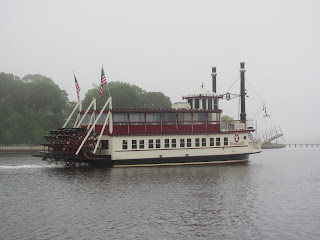
Anchored for three days and two nights in this rainy, cloudy and cool spot, we were starved for a change of scenery, so the paddlewheeler River Lady was a welcome distraction. Very few tourists were on board!
No matter the rain and cloudy weather, the locals were out at the start of the season on their boats. The cat boat Silent Maid was quite a beautiful craft as she sailed past our stern.
And when a ray of sun broke through for just a few minutes, it seemed to be a Kodak moment!
Tuesday, May 22, 2012
May 18 - 19, 2012 - Ventnor & Atlantic City, NJ
The weather is not cooperating with us for an offshore passage to Atlantic Highlands and New York City, with high winds predicted for a week! We don’t want to be in the North Atlantic in 6-7 footers. So after checking with recent cruisers on an inside passage, the New Jersey Intracoastal Waterway, we decided to give it a try. We departed Cape May at 1300 hours, to catch the rising tide.
Seafood is a big commercial industry in Cape May, as this sizeable fishing fleets attests. Offshore waters are home to tuna, marlin, lobster and other delicacies.
We have always traveled offshore north from Cape May, as the New Jersey ICW is notorious for shoaling. It lived up to its reputation, with less than ½ foot under our keel near this dry area. Later, we had a “soft grounding” – no damage, but had to power off the sand bar.
New Jersey-ites like their waterfront, with cottages lining the banks.
The houses are packed tightly along the ICW in Sea Isle City.
For the night’s anchorage, we found this nice protected basin at Ventnor, New Jersey, just south of Atlantic City. Right on the seashore, the town’s motto (every town needs one) is “Shore-ly the best!”
The next afternoon, after doing some navigational research, we discovered that a few bridges we needed to have opened for Monarch, wouldn’t be operating until after 0700 the following morning. We needed to be underway well before then to make maximum use of a rising tide. So we decided to pull anchor, do the bridges now and select an anchorage just north of Atlantic City. We passed first through the narrow Dorset Avenue Bridge.
We knew we were in Atlantic City by this scow serving as a planter,
and by numerous casinos along the horizon. This is Harrah’s Resort and Casino, the tallest hotel in Atlantic City, with a150,000 square-foot casino and more than 2,800 slot machines.
The Water Club Hotel is reflected in the mirrored surface of its companion, the Borgata Casino.
It was hard to find an angle of the city where a casino wasn’t front and center. This may be one!
We anchored in Broad Creek, within sight of the casinos. Harrah’s hotel building, at least 65 stories tall, served as a nighttime animated billboard, advertising the performance of magicians Penn & Teller……
…….and to “Jessica – will you marry me?”
The casinos are active 24-7. We’re not, so we were off to bed to be up at 0530 tomorrow.
Subscribe to:
Comments (Atom)


