Thursday, December 3, 2009

November 30, 2009 - Marco Island, Florida

This morning dawned clear and calm, a beautiful powerboat day! We departed the skinny entrance of Pelican Pass and made our way to the Gulf, for an offshore run.
The adjacent Boca Grande Pass is well marked by the Boca Grande Lighthouse, which we had toured two years ago. This pass is the entrance to Port Charlotte and Charlotte Harbor.
We headed directly for Marco Island. We had hoped to spend a couple nights at anchor along the way, but a water pump on the port engine started a slow drip. We called the marina on Marco, who said come right in for a fix! So, we had a couple unexpected mechanical lay days.

Now that we are on Marco, we will leave the boat at a dock for about a month, to visit Michigan. Stay tuned for the further adventures of Monarch, resuming in mid-January.

Wednesday, December 2, 2009

November 26-29, 2009 - Thanksgiving at Cayo Costa, Florida

We departed Longboat Key early Thanksgiving morning, to make our way south to one of our favorite anchorages, where we planned to have our Thanksgiving dinner.

The cloudy morning gave way to sun and a brisk north breeze, directly behind us, helping us push south. We were in the Intracoastal Waterway, protected from the waves that were on the Gulf.

It was a pleasant trip, with lots of dolphins playing on our wake and leaping ahead of our bow. There were several large dolphins that flew out of the water, seeming to say, “follow us!” So we did.
We entered Pelican Bay at Cayo Costa anchorage to find about 55 boats already here! It is a holiday weekend, after all, and many local boaters had claimed their spots. Fortunately, this favorite anchorage is large and we poked around until we found a place we liked.
We got the anchor down, and did a pork loin on the barbeque, with potatoes, squash, fresh tomato basil salad, and pumpkin turtle chiffon pie to finish.
We were thankful for all our many blessings, including the next few days of rest and relaxation right here in Pelican Bay.
Early in the morning, the fishermen are using their cast nets to catch mullet.
In the dinghy, we visited the adjacent hurricane hole, where 18 boats were rafted. We had never seen so many boats in this small harbor.
The Punta Gorda Sailing Club had a holiday rendezvous here, with two rafts of five boats each, and other boats, in attendance.
We see some of the most beautiful sunsets here.
This silhouetted sailboat is framed by the day’s last light.
Another day saw us shelling on the beach of the State Park at Cayo Costa.
The beach walkers do not disturb this osprey.
The day was sunny and became calm as the afternoon progressed.
The moon rose early over Monarch.
Another good day, as we live the dream!

Monday, November 30, 2009

November 25, 2009 - Completing the Loop at Longboat Key, Florida

The day dawned cloudy with mist and rain. But it was a momentous day for us, as today we would complete the “Great Loop,” the waterway that circles the Eastern half of the United States.
There are just a few bridges on this coast from which we require an opening. The Belleaire Causeway Bridge is one of those, and the bridge tender did a lift for our passage. Most bridges can accommodate our 23½-foot height.
The Sunshine Skyway Bridge over Tampa Bay is one of the most striking bridges on the Florida coast, although the clouds and mist made it less so today.
In spite of the brisk north wind, mist and rain, this kayaking fisherman was undeterred. Note in the background, the ribs of a shipwreck, festooned with cormorants.
Near the end of the day, we crossed the northernmost point we had visited on the Florida coast about 18 months ago, at 27º26' 35" N, 82º40'59" W. This was the completion of our “Great Loop” and we celebrated with lobster, stone crab, shrimp and a nice Merlot at Moore’s Crab House Restaurant on Longboat Key. They have a sturdy dock, where we spent the night.
And here’s a bird’s eye view of the “Great Loop” route we traveled. With side trips to the Bahamas, Lake Superior, and an extra trip down the East Coast, we have traveled a total of 10,436 nautical miles on the “Great Loop.”

November 23-24, 2009 - Overnight Crossing of the Big Bend

We waited for a good weather window to do our crossing past the curve of the Florida Panhandle called the “Big Bend.” This open water Gulf crossing shortens the distance by about 75 miles, making a straight line from either Apalachicola or Carrabelle on the Panhandle, to the southern cities of Tarpon Springs, Clearwater or Tampa.

The distance of 185 miles is too much to be made in daylight hours this time of year. So, many boaters depart in the afternoon, go throughout the night, and arrive in the morning of the following day. It is important to transit the coastal area at the beginning and end of the journey in daylight, as the crabbers have their crab traps scattered at random in 30 feet of water or less on each coast. These traps have lines that can become entangled in propellers and shafts, causing big problems for boaters!

So, with favorable, moderate seas predicted for the night of November 23, Monarch and nine other boats decided to make the crossing. We got a taste of night navigational lighting the evening before our departure, as Buddy’s Boys shrimp boat went out for an overnight run – all lit up.
And as we departed at 12:30 p.m. on November 23, we felt it was a good luck sign to see the Miss Martha, a shrimper offloading her catch.
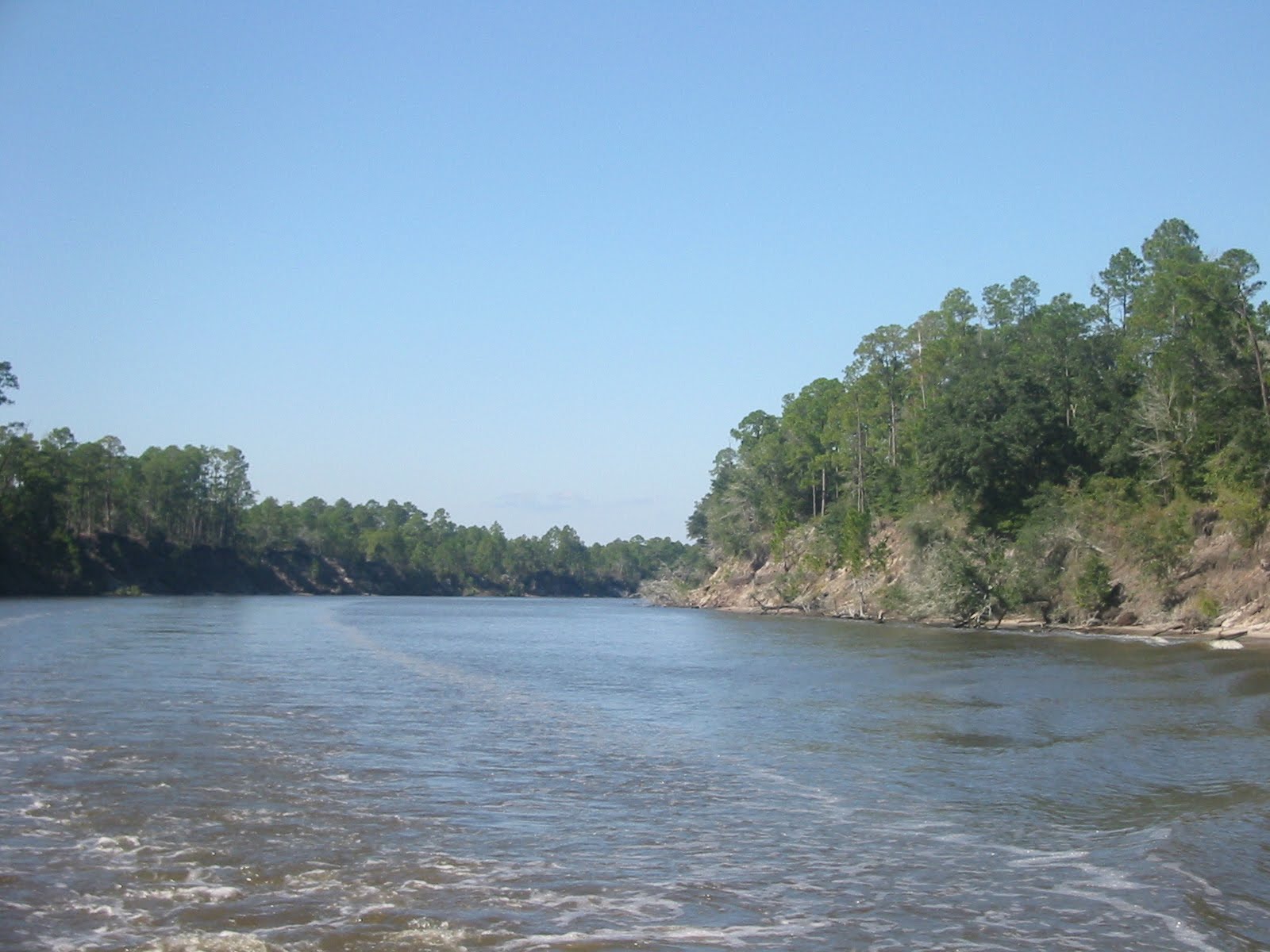
Apalachicola Bay was calm, wide and shallow, but well buoyed, and we had other good luck signs of loons and dolphins playing in our wake. We were ready for the big crossing.
The Government Cut pass into the Gulf was well marked and easily navigated.
St. George Island is the barrier island that separates Apalachicola Bay from the Gulf. It is heavily built up with homes, much more so than Apalachicola.
As the sun set, the clouds came in, and the winds were at direct opposition to the 3-4 foot seas. The ride was lumpy and bumpy, and the pitch-black night fell. We were glad for our GPS, our computer charts and navigation, and our old-fashioned back up paper charts and 30-minute dead reckoning fixes. And we could see the navigation lights of our fellow boaters headed the same way, and talk to them on the radio. The two of us on Monarch took turns standing watch and trying to catch a quick nap.
The dawn came at 0700 hours, with a large pot of coffee, a bit of fog, and lots of crab traps! We transited the Clearwater Pass, and were tied up at the Clearwater Yacht Club docks by 0840 hours. After hosing the salt water off the boat, we headed to bed for a four-hour nap!
We did a few boat chores and had a prime rib dinner at the Yacht Club. It was an early to bed night, and we’ll be ready to resume our GICW cruise in the morning.

Sunday, November 22, 2009

November 19 - 22, 2007 - Apalachicola, Florida

All along the GICW, the curving river intersects with bayou after bayou. It’s a beautiful area.
And here’s a nice piece of riverfront property.
We think the one above must have gotten lost from the adjacent field of houseboats, tucked in a bayou just off the channel.
We crossed into the Eastern time zone (sprung forward) that we had departed at Chicago six weeks ago. Then we passed this railroad swing bridge. It stays in the open position unless a train is coming.
Our destination is Apalachicola, Florida. This Panhandle city has a rich history and maritime culture, along with bountiful natural resources. The bounty of the sea is evident from the scores of shrimp boats with their booms and nets.
This area also has alligator. The only one we saw was on the menu at a local restaurant, billed as “fresh-caught in Scipio Creek” which is where our marina is located! So swimming is REALLY not a good idea!
The shrimp boats cruised past Monarch at her dock, all day and all night. This one was towing in a disabled fellow shrimper, who must have lost his engine.
Here, they temporarily “park” in the reeds, so the first vessel could reel in his booms, reducing his width enough to navigate the increasingly narrow channel.
The town has about 900 historically designated buildings, and the city has constructed a walking tour of 35 of those, within an area about six blocks square. We did more than one walkabout in the three full days we were here. This is the First United Methodist Church. Built in 1846, a kitchen fire in a nearby house destroyed this and 72 other downtown buildings. It was rebuilt in 1901.
The Coombs House was considered the most elegant residence in Apalachicola when a local lumber magnate built it in 1905. It is a classic Queen Anne style home with ornate verandas, and is now a B & B.
This is the Three Soldiers, Detail statue, honoring soldiers who fought in Vietnam. It is cast from the original mold of the Washington, DC Vietnam Veteran’s Memorial Three Servicemen Statue.
Adjacent to the memorial is the Orman House, a Historic State Park. Built in 1838 by slaves, the wood for this two-story house was cut to measure in New York and shipped to Apalachicola via sailing vessel around the Florida Keys.
We saw many monarch butterflies while here, this one in the Botanical Gardens adjacent to the Orman House. We think this area is on the migratory path for the monarchs, as well as for us! We later returned to the Gardens for a fund-raising weenie roast, to raise money so the local police and fire departments can buy toys for Christmas for needy children in the area.
Built in 1838, the Raney House was placed on the National Register of Historic Homes in 1972. It is owned by the city, and provides a glimpse of life in the early 1800s.
The Gibson Inn was built as a hotel in 1907, and is the cornerstone of the preservation efforts in Apalachicola. It is one of the few inns on the Federal Register of Historic Places that is still operating as a full service facility.
In addition to shrimp, oysters are a local delicacy. This is a small pile of shells near a processing plant. We saw other shell mounds that were at least as high as a two-story building. We see that the shells are used for roadbeds, as we would use gravel up north.
This city is a charming, seafaring town, with lots of local charm and very few chain stores or fast food franchises. The restaurants are many and varied, with excellent oysters, shrimp and fish, and pecan pie as staples. We sampled them all!

Saturday, November 21, 2009

November 18, 2009 - Smack Bayou, Florida

Today took us through a man-made straight-cut canal as part of the GICW (Gulf Intracoastal Waterway). Called the Canyon, the banks were deserted, with an occasional large field of sand from dredging, along the side.
After the man-made portion, the natural serpentine river provided more interesting scenery.
And in West Bay, where the river widens substantially, the dolphin frolicked under our bow, matching their speed to that of Monarch.
Tonight’s anchorage is Smack Bayou. Jerry says it’s named after the dolphins that smack the water to get our attention.
This area is adjacent to Panama City on the Panhandle of Florida, but tucked in here we feel pleasantly isolated.
This area is billed as a hurricane hole, that is, an area where safety may be sought in hurricane conditions. We think that this theory didn’t work very well for this sailboat, now home to roosting birds – when it sticks out of the water at low tide! Fortunately, the wreck is buoyed, so mariners know not to go there during high tide.
Check on where Monarch is today and all of the locations it has visited at the following site -
By checking out the log you will see all of the locations we have been visiting......