Saturday, July 25, 2009

July 24-26, 2009 - Stockton Island, Wisconsin

Today we departed Bayfield for Stockton Island, about 16 miles northeast.


This island is the most popular spot in the Apostles, as witnessed by the 16 boats in our anchorage. We hadn’t anchored with this many boats since the Bahamas!


We anchored in Julian Bay, which has one of the longest sand beaches in the islands. This sand is a pink quartz, with all grains round and of the same size. The park ranger told us the sand “sings” if you rub your hand rapidly over the surface. It does!


We took the dinghy in for our walkabout. A little farther inland is an extensive “lagoon” system, home to numerous water birds.


The National Lakeshore has established several walking trails of various lengths throughout the island.


We chose a path about four miles long, through the woods and marshes.


The island also has 19 camping sites, widely scattered along the southeastern shore, with lots of privacy and beautiful views of the bay.


The path winds through blueberry territory, which were just beginning to ripen. While we didn’t see any, over 20 bears also roam the island. Marty had her bear whistle around her neck just in case.


As the path came out by the water, we saw sailboats coming our way.


We saw “facilities” which were limited to vault toilets and a visitor center for nature lectures. There also is a small harbor with enough room for a half dozen boats.


We hiked again on the second day of our stay. The shoreline was reminiscent of our own Stag Island.


The trail was beautiful, with large trees and deadfalls.


We saw beautiful flora, including these blue bead lilies. They have yellow flowers earlier in the season, followed by blue berries on the ends of 10-inch stalks.

Marty found a hidey-hole in the base of this giant birch tree. It is rare to see a birch so big.


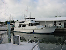
We returned to the boat for the evening…..


…and were treated to a beautiful sunset. Tomorrow, weather permitting, it is off to Isle Royale!

Thursday, July 23, 2009

July 21-24, 2009 - Bayfield, Wisconsin


We discovered yesterday that our dinghy outboard wouldn’t start, so today we docked at Port Superior Marina, just outside of the town of Bayfield. This well-protected marina with 211 slips provides all cruising amenities, including on-site mechanics and a complete ships store.


We had planned to dock in the area in any case, as Jerry’s childhood friend, Janet Carlson (Bullock), summers in Bayfield. Population 610, this charming and historic town is a pleasant stopover for us and many other boaters. It has numerous restaurants and art and gift shops typical of towns catering to the tourist trade.

Bayfield was established in 1856, and is named after Admiral Henry Bayfield who conducted the first complete survey of Lake Superior. Lumbering, fishing and sandstone quarrying were the basis of the town’s affluence.


Now, orchards and berry farms have become big business. Here, Marty picks the season’s first blueberries from a nearby farm.


Many of the buildings of the town are on the National Register of Historic Places, including this commercial building which our friend Janet and her husband Tom have restored.


Their home is also on the Register, and had been beautifully restored. It had been home and office for the town doctor in the 1800s.


The surrounding yard is beautifully landscaped with plantings and fountains.


Our friend Janet served as our tour guide, car loaner and fine-dining establishment, while husband Tom was out of town on business. We missed you, Tom!


Here Marty is in Janet’s classic Mercedes loaner car, making friends with Janet’s cute dog, Woodi.


Janet took us in her runabout boat to Madeline Island, the only one of the Apostles Islands not part of the National Lakeshore. It has a small year-round population that swells in the summer. The local watering hole here is Tom’s Burned-down Bar, which burned down years ago and has been replaced with a tent!


The local fish market provided smoked trout and a tasty fish spread.


We have had many days of rain showers, and while in Bayfield had some thunderstorms one day and socked in fog another day. We were glad to be tied to a good dock during these times.


July 20, 2009 - Raspberry Bay, Apostle Islands, Wisconsin

We waited for this fishing tug to dock before we cast off. Today will be a shorter day, as the Apostle Island, our next stop, are just 37 miles away.


The day was calm and sunny, as we made our way out the narrow entrance into Lake Superior. It is the first day in two weeks that is warm enough to pilot the boat from the upper flybridge.


Michigan Island Light welcomed us to the Apostle Islands. Located off the Bayfield Peninsula in western Lake Superior, these 22 islands cover more than 720 square miles, and provide some of the best cruising on the lake. In 1970, the US Congress established this area a National Lakeshore, to preserve and develop the islands for the enjoyment of all.


Most of the islands have rugged sandstone bluffs on the northern shore, and sandspits at their southern extremities. Our first anchorage in Raspberry Bay has the rugged shoreline, in this case topped by a beautiful stand of birch. The shoreline here belongs to the Red Cliff Band of Chippewa, and we heard Indian chanting in the distance as the sun set.

July 19, 2009 - Black River Harbor, Michigan


Once again, we’re underway. We passed under the lift bridge and made our way north on the Portage Canal.


Coming around a bend, we quickly hugged the shore to stay out of the way of Ctetia, a cruise ship we had seen docked in Houghton a few days ago.


The North Entry Light marks the entrance to Lake Superior. We then traveled a little over 70 nautical miles to our next port, the Black River.


This harbor is very difficult to pick out of the surrounding hills. The recommended visual clue is the Copper Peak Ski Jump, on top of the highest hill, and visible from over 35 miles out!


The Black River Harbor is within the Ottawa National Forest. It is a small harbor, well protected, about 12 miles north of Bessemer.


The US Forest Service has done a nice job of developing the recreational area, with campgrounds and picnic areas in addition to the harbor. There are a number of trails leading to impressive high overlooks of Lake Superior. Other trails lead inland on both sides of the river to a series of five beautiful waterfalls.


This suspension footbridge leads over the Black River, where the path takes us through a virgin timber stand.


These giant pines are part of the remains of the large forest that once covered the entire southern shore of Lake Superior.


Rainbow Falls is the first of the series of falls. It cascades 45 feet to the rocks below.


In the heavy shadows of this pine, you can see how small Jerry is.


On the opposite side of the river, we got a good view of Monarch.


The bridge, built in the 1960s, is supported by huge timbers, and sways slightly when crossed.


Back aboard Monarch, the evening shadows came early, as the high forested hills hid the sun. After our hike up and down the steep hills, we were hungry for dinner and pleasantly weary for a peaceful night’s sleep.


Wednesday, July 22, 2009

July 12-18, 2009 - Houghton, Michigan

Today, we traveled the short distance to Houghton, where we will dock for a week.


We passed by Michigan Technological University, Marty’s alma mater, where she will attend a board meeting later this week.


Other familiar sights included the University’s ski hill, Mount Ripley, sporting its summertime greenery.


Marty made lines ready as we approached the marina and the lift bridge spanning the Portage Canal. This is the largest lift bridge on Lake Superior, and is said to be the heaviest lift bridge in the world. The lower level was originally constructed for railway transport, and is now used in the winter as part of an extensive snowmobile trail way.


The waterfront bears signs of the now-defunct mining industry.


We docked at the Houghton County – Hancock Marina, on the north side of the canal.


As we enjoyed our stay here, we frequently looked out to see the lift bridge opening for vessels, like this tug and barge combination –


-- and the Ranger, the National Park Service vessel which takes visitors to Isle Royale, some 54 nautical miles north across Lake Superior.


We enjoyed entertaining many friends while at the marina, like these MTU board members appreciating the sun on our aft deck.