Tuesday, August 18, 2009

August 8-9, 2009 - Whitefish Point, Michigan

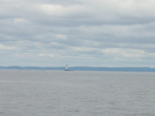
Next stop is Whitefish Point. The weather was overcast, but relatively calm, as we passed this tug and barge.
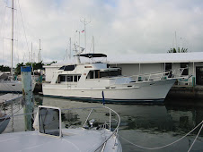
As soon as we rounded Whitefish Point, the waves were steep and close. We were glad to only have about 45 minutes to the Harbor of Refuge here. Jerry navigated the narrow entrance in beam seas, and shortly had us safely moored at the inside wall. We took some big waves over the breakwall and onto Monarch while she was moored.

That evening we had Joanne Darling over for dinner aboard. She is Marty’s cousin Chuck wife’s Cynthya’s mom, who spend summers at her cottage in nearby Paradise.
The rough weather had resulted in a full house here at the harbor. We watched a sailboat depart the next morning, with a great deal of bobbing and broaching, so we decided to have a lay day here to wait for better weather.
Taking advantage of the day in port, we recalled our walk here a month ago, and the unripe blueberries we saw along the road. We revisited them, to find them ripe for the picking.
It had been many years since we had picked wild blueberries. We picked with one hand and swatted mosquitoes with the other!
In all, we picked about 1½ quarts. In our future were blueberry waffles, blueberry crisp alamode and blueberry buckle!

Monday, August 17, 2009

August 7, 2009 - Grand Marais, Michigan


The next morning, we were headed east again. With the morning sun, we could only see parts of the Pictured Rocks in shadows, yet could see through the Grand Portal’s “cave.”


Once around the point, the sun illuminated this section of the Pictured Rocks, and some looked as though they were cut to a fine square edge.

This is called the Flower Vase. Note the evergreen growing as the “flower” on top, with its roots connected to the mainland!

Along the shore, Spray Falls drops right into Lake Superior.
Moving past the Pictured Rocks, we saw the massive Au Sable Dunes. On these dunes is the Devil’s Chute. In lumbering days, the logs were slid down this natural chute into Lake Superior, were collected in booms, and transported the few miles to Grand Marais for processing at the mill.

Grand Marais was our port for the night. The locals were hosting a music and arts and crafts fair, which we perused before the all-we-could-eat whitefish dinner at the Sportsman’s Restaurant, and turning in for the night.


August 6, 2009 - Grand Island, Michigan

We left Big Bay this morning, and headed offshore and directly for Grand Island, just off Munising. We charted a course just north and east of the island, in order to backtrack past the amazing Pictured Rocks highlighted by the afternoon sun. We were glad we did!

Grand Portal is the prominent point where we began our close-in tour of the Pictured Rocks, designated the country’s first national lakeshore in 1966. You can just make out the hollow area under this formation.
Massive glaciers inched back and forth across this land for a million years, scouring and molding the 500-million-year-old Cambrian sandstone, and pre-Cambrian Jacobsville sandstone.
The Gull Rookery shows the effects of centuries of onslaught by Lake Superior, where battering waves and ice continue to sculpt the cliffs.
Just in front of Jerry is Sail Rock, a triangular rock perched against the shore.
This shows streaks that occur when groundwater drips out of cracks, leaving behind the colorful stain of iron, manganese, limonite, copper and other minerals.
This sculpted profile is called Indian Head.
Lover’s Leap would take care of that broken heart.
At the base of the cliff, you can see the Caves of the Bloody Chiefs
Painted Coves display especially vivid orange and deep rust colors.
Miner’s Castle has a visitor’s overlook accessible by land.
We were glad we took the time to see these in the afternoon sunlight.


Next, past the East Channel Lighthouse and into Murray Bay on Grand Island for the night’s anchorage.

Tuesday, August 11, 2009

August 3, 2009 - Big Bay, Michigan

On a calm day, we made our crossing from Isle Royale to Houghton on the mainland. Because the Yamaha dealer is here, we stopped to have our dinghy outboard repaired. Gary, the mechanic, really knows his stuff, and after ordering the necessary parts overnight, he fixed us right up.


In the meantime, we had fun with Russ and Char Gronevelt who were at their cottage in Dollar Bay, and watched the sun set behind the Lift Bridge.

Off again to make our way eastward. We headed across Keweenaw Bay for our night in the harbor at Big Bay.


This is a secure little harbor, where we were the only transient for the night. There were numerous seasonal small boats here as well.


We went for our walkabout into town, about a mile uphill. This town is famous as the filming site for the movie “Anatomy of a Murder.” In fact it was 50 years ago that Jimmy Stewart, Lee Remick, George C. Scott, and other famous actors came to this town – and to this building – to film the movie, based on the 1957 novel by John D. Voelker, Ishpeming-born Michigan Supreme Court Justice.


The book and screenplay are based upon a true story that took place in Big Bay, of a jealous husband who shot and killed the bartender in this establishment. The bartender had apparently taken a fancy to the guy’s attractive and somewhat wayward wife. The husband was acquitted by virtue of temporary insanity, the first successful use of this defense in the state of Michigan. Today, the building is the Thunder Bay Inn, a hotel and dining establishment – with of course, the bar!

Thursday, August 6, 2009

August 2, 2009 - Isle Royale National Park


After dropping of our guests, we made our way back to a secure dock in Moskey Basin. The wind was whipping on the big lake, so we selected this bay to wait it out for our crossing to the mainland. We were alone at the dock.


We had heard there was a moose and calf at nearby Lake Ritchie, so we set off on this 5-mile round trip hike.


While we didn’t see the moose, we did enjoy a beautiful hike and sunny skies.


The lake features a campground, and we passed canoers portaging on the trail from Moskey Basin to Lake Ritchie.


Back aboard and on the aft deck, as the wind died, we gazed down the three-mile long basin. As we put our feet up, we heard a great deal of splashing around the hull. Looking over the side, we spied two otters playing in the water, almost close enough to touch!


Shortly after sunset, we enjoyed the civil twilight, and turned in for the night.

July 30 - August 2, 2009 - Isle Royale National Park


We welcomed friends Tamara and Andy Byerly today, in Rock Harbor, the 12-mile long channel that runs parallel to the island’s southeastern side. They arrived on the Isle Royale Queen from Copper Harbor for a few days of wilderness experience.


We loaded their gear aboard and headed past Rock Harbor Lodge, the island’s only accommodation other than camping sites. A loon was fishing just offshore. Isle Royale is home to 100 nesting pairs of loons. Normally solitary creatures, we saw a flock of ten swimming together.


Most of Andy’s gear was fancy photo equipment, which he quickly set up on deck in Tobin Harbor. This area has been a favorite of visitors since the early 1900s, when this all-weather harbor was the site of many summer homes. Visitors would come by steamer from Duluth for the summer, and we could see some remaining cottages, whose occupants have been granted life leases from the Park Service.


That afternoon, we dinghied to shore for the hike uphill to Lookout Louise, about 800 feet above the lake level.


The beautiful rocky outcroppings made for good exercise and photo opportunities, this photo taken by Andy.


At the top, we looked out on one of the most spectacular vistas in all of Isle Royale.


We could see all the way to Ontario, Canada from here. Way below was a powerboat that had worked its way into the bay to anchor.


The trail featured many interesting flora and these mushrooms.


The next day, it was up anchor and off to one of the area’s most beautiful harbors, Chippewa Harbor, on the south shore of Isle Royale. Its only access is through a narrow channel from the greater lake, which makes it well protected in its variety of anchorages.


We worked our way to the most inner harbor through a narrow, rock-walled channel. We anchored inside, all by ourselves for the night.


Of course, we had fine dining on the aft deck.


The wind died, and we enjoyed the view of perfectly mirrored shoreline, followed by a quiet night’s sleep.

The next day, the winds had picked up, and we hurried to get under way to miss the high waves that were predicted. We were a bit too late, and once more were surfing down 7-8 footers on our way back to Rock Harbor. We docked once again at Caribou Island, and the next morning dropped our friends Tam and Andy back at Rock Harbor dock, for their ferry ride back to Copper Harbor. A good time was had by all!

Monday, August 3, 2009

July 26 - 29, 2009, Isle Royale National Park


Today we arrived for our long-awaited visit to Isle Royale. We entered the area of island from the southwest end, headed for Washington Harbor, marked by the Rock of Ages Light.


This roadless land of unspoiled forests, refreshing inland lakes and rugged, scenic shores is accessible only by boat or seaplane. In the picture you can see a seaplane at the dock, which is moored at Barnum Island. This island is one of the few with life-lease private cottages, left over from the days when Isle Royale was a vacation getaway for people from Duluth and Chicago.


We found a beautiful dock at Windigo Ranger Station, where we tied up for a couple nights.


Windigo, from Ojibwa legend, represents an evil spirit that haunted the natives during long winters of starvation, causing them to look at their relatives as a possible food source! Here, Marty gets into the “spirit.”


The beautiful visitors’ center displays history and artifacts of the area, including the second order Fresnel lens original to the Rock of Ages Light. One evening, we attended an interesting ranger-led discussion about the wolf and moose populations of the island.


The dock was quiet, except for a couple other boats and the Voyager II, the ferry that brings campers from the Minnesota shore.


Walking the island we are struck by its striated layout and elongated rock ridges that parallel its backbone, Greenstone Ridge. The island and its basins were gouged out by glaciers and look like giant clawmarks. And the island is covered by interesting vegetation.


We saw Canadian Dogwood, also known as Bunchberries.


This Coral Root looks like it could be part of the orchid family.


Cow Parsnips are a skin irritant, so we didn’t touch!


We were amazed at how tall the Cow Parsnips grow – over seven feet.


The path was crossed by several streams, flowing into Washington Harbor.


Skunk Cabbage grew along the creek.


Fireweed was also prolific.


We hiked almost two miles straight up, to the top of a ridge where we viewed the Grace River…..


……..and the swale formed in the valley below.


This is Red and White Baneberry. The white variety is also known as “dolls eyes” as it has black dots on its white orbs.


These moss spires are connected underground.


The Shinleaf is reminiscent of Lily of the Valley.


After a couple nights at Windigo, we made our way east, toward Siskiwit Bay. On the way out, this seaplane landed right off our stern. This looks like the way to travel.


The day’s predictions were for 3-foot waves, but once on the big lake, we were in 7- footers! Fortunately we were going with the waves for most of the trip. We got safely into Siskiwit Bay and anchored for the night further inside, in Hay Bay. This area is billed as “likely to see moose,” but while there, we didn’t. We did see a pair of bald eagles, always a treat.


And we were treated to this rainbow, which appeared as an afternoon shower had passed.


Next up is Caribou Island. We found the entrance just off the Middle Island Passage Light.


This dock was just the right size for us. It is adjacent to the Caribou campsite, which has two shelters and two outhouses. These were occupied by canoers and kayakers, who put their sleeping bags on the shelter floor. A fire-ring and picnic tables were dockside, and we shared the campers’ fire that evening. We were interested to hear their Isle Royale tales, as they were repeat visitors.