Thursday, July 26, 2012

July 18, 2012 - Otter Head, Ontario

We are enthralled with the anchorages on the north shore of Lake Superior, so many to choose from and so little time! So today it’s onward to Otter Cove, an almost landlocked harbor framed by majestic bluffs, reminding us of a fjord. The cliffs towered 300 feet above this 60-foot high sailboat mast, our only neighbor for the night.
This area is part of the expansive Pukaskwa National Park. Only an abandoned shack and a little-used park warden’s cabin – complete with the pictured outhouse, are in this three-mile deep harbor. We proceeded as far into the cove as we could, anchoring across from a waterfall.
We could hear the waterfall, but even in the dinghy could not see it, as the creek was well hidden by a dense growth of trees.
The forest barely showed this tiny cabin right on the creek. Perhaps they got their running water from the hidden waterfall.
A dinghy excursion took us several miles to see Otter Island, just off Otter Head, the point that cradled Otter Cove. On the island’s north end is another harbor, called Old Dave’s, complete with an abandoned fishing camp in disrepair. This is the harbor that services the Otter Island Lighthouse, now automated. A herd of threatened (and shy, we didn’t see any) Woodland Caribou resides on this island.
Darting across to the mainland, we cruise by beautiful Cascade Falls that plunges directly into Lake Superior.
Back aboard Monarch, we weigh anchor and cruise north through the heart of Pukaskwa National Park. Established in 1983, the park encompasses some 725 square miles of incredible scenery. The rugged shoreline along the coast is stunning, with striated rock formations of contrasting colors.
In the heart of the park, we anchor in Pulpwood Harbor, aptly named for the time when logging was at its peak and 30” diameter log booms were chained or cabled together to corral smaller pulpwood for water transport. We can still see wire cables left behind on the shore. The entrance to our secluded anchorage was scarily narrow, bisected by this tiny island, and yet more than 30 feet deep! The sunset was spectacular.
In the dinghy the next morning, we set out to explore the area. While in our anchorage we were wonderfully secluded, in the next harbor north lies a 67-site campground….
….and Visitor Centre for Pukaskwa Park. This area of the park has hiking trails in easy, moderate and challenging levels (one over 37 miles long one-way), many with stairways and boardwalks to help navigate steep cliffs and wet areas.
This birch lodge is authentic to the Anishinaabe natives, who peopled the north shore of Lake Superior for generations. A First Nation interpreter kindly snapped our photo here.
We hiked several of the trails, including the Southern Headland Trail, which provided breathtaking views of the coast of Lake Superior.
At the top, we gazed out over Superior as we had a picnic lunch.
The path often took advantage of a narrow gap in the rocks.
The Beach Trail took us on Horseshoe Beach, where huge driftwood had been piled up by the prevailing westerlies.
We hiked the just-opened Manito Miikana (Spirit Trail), which had bridges over steep ravines. Here we picked wild blueberries for later use on waffles.
Flights of stairs helped us scale the nearly vertical areas of the trail. We developed quite an appetite from our miles of hiking, and satisfied this with a great meal back aboard Monarch.

Wednesday, July 25, 2012

July 13 - 15, 2012 - Into Lake Superior

This morning we departed Sault Ste. Marie as the bow of the Laker Algoma Mariner loomed large through our salon doorway. She was headed for the MacArthur Lock.
We entered the Canadian Canal Recreational Lock. This was our first transit of this lock, as last time we passed through, it was closed for repairs and we used the much larger commercial MacArthur Lock. In the distance is the International Bridge, celebrating its 50th birthday. There is lots to celebrate locally, as this year is the 100th birthday of Sault Ste. Marie, Ontario, and the 200th anniversary of the War of 1812, which saw some action nearby.
One of the most elegant lockkeepers cottages we have ever seen is right next to this lock.
Now we are in Lake Superior, so named by early explorers not because it is the largest (though it is, with a surface area of more than 31,000 square miles) in the world, nor the best (though some would argue it is) of the Great Lakes, but because it is most northerly, and at the highest elevation above sea level. We took the northern route along the Ontario shoreline, where hundreds of wind turbines provide green power for the local utility, taking advantage of the reliable westerlies.
Our night’s anchorage is in beautiful Batchawana Bay, near a provincial park of the same name. Trans-Canadian Highway 17 runs along the eastern shore here. But we couldn’t hear if from the Harmony Bay part of Batchawana Bay, a beautiful, large, protected and secluded place to set our hook. The water was an unexpected 75 degrees warm; soon, we took a refreshing swim.
The next night’s anchorage in Sinclair Cove came highly recommended, not only for its protected basin, but also for fascinating ancient rock paintings just around the corner at Agawa Rock.
Just ¼ mile from Monarch, toward the Agawa Islands are these Ojibwa pictographs, at the water’s edge beneath thirty-meter high overhanging cliffs. Visitors are able to hike here, but we took the dinghy in for a better look.
The red ochre (made from hematite and grease) paintings tell a story of a four-day canoe trip led by great Chief Myeegun from the Carp River in the Porcupine Mountains to Agawa Rock – a distance of 215 nautical miles across Lake Superior.
If you look closely, you can make out canoes, horses and maybe a caribou, or a horned and spiny reindeer. The images are about four feet tall, and date to the 1600s. They are fading as the years go by, so we were glad to see them.
We enjoyed our night on the hook here, and in the morning departed for Michipicoten Island, Lake Superior’s second largest island. The island is 40 miles from the north shore of Lake Superior, isolated and pristine. Early natives were superstitious of the island, due to its undulating appearance, sometimes disappearing in the fog. And today it did!
Along Michipicoten’s south shore we find the entrance to its most secure anchorage, Quebec Harbor, at Davieaux Island Light that is barely visible through the fog. Now automated, this light had a keeper, Gordon Dawson, who manned this remote light for 22 seasons.
Early explorers and natives valued copper deposits on the island, but these were not substantial enough to prove commercially viable. After copper, the fishing industry drew settlers to the shore, with a succession of three fish companies manning a station in Quebec Harbor. We can see the remnants of the station through a band of fog. Today, fishing tugs visit the harbor from the mainland’s Mamainse Harbor, and we see a blue and white turtleback at the dock. The buildings are in disrepair, though there are a few summer camps on the west end of the harbor.
We took up binoculars for a wildlife watch from the aft deck, and were not disappointed. We saw bald eagles, loons, black ducks, goshawks and a beaver. Over the course of the afternoon, we spotted the real highlight – more than a dozen caribou. These were introduced to the island in the 1970s, and are about the size of a small horse, with coats a mottled gray, the bucks with impressive velvet-coated antlers. A cow with a fawn-colored calf loped along the shoreline.
The peaceful setting was the perfect place for our night’s anchorage.

Thursday, July 12, 2012

July 10 - 12, 2012 -- Mackinaw City to Sault Ste. Marie

Back on the water, we depart Mackinaw City on our trek northward toward Lake Superior.
We head into Detour Passage, and pass the Drummond Island Ferry on its regular trip to the island from Detour.
It is a beautiful powerboat day as we pass Lime Island, where a defunct limestone mining operation is still in evidence. Now, it is a Michigan campground, with cottages available for rent, and campers welcomed.
The St. Marys River is the main artery to the Soo and Lake Superior. At Neebish Island it splits into an eastern channel upbound, which we take, and a western, which the Algocanada takes, downbound.
The eastern, upbound channel is lined with cottages, and this quaint church is adjacent to a navigational range light.
We anchor for the night just off East Neebish Island, a quiet and peaceful spot, where we enjoyed a glass of wine as the sun went down.
The morning dawned sunny and warm, and we headed up the St. Marys River to Sault Ste. Marie. We docked early at George Kemp Marina on the U.S. side, so we could do some major cleaning on Monarch. As we worked, we watched a busy day of thousand-footers and lakers going through the locks.
Right next door to the marina is the museum ship the Valley Camp, decommissioned from the Republic Steel Company. Tomorrow we are off to the Canadian side of Lake Superior, where we will have limited access for blogging. So be patient until we find a wi-fi hot spot.

Saturday, July 7, 2012

June 24 - 30, 2012 - North Channel and Straits of Mackinac

Under gray and rainy skies, we pulled anchor and motored north to our favorite cruising grounds, the North Channel. We pass Strawberry Island Light.
We just missed the hourly opening of the one-lane Little Current Swing Bridge, which is the only bridge accessing Manitoulin Island, the world’s largest fresh water island. We idled around, and finally it was time to pass.
A couple hours west of Little Current we anchored for the night with three other boats in Clapperton Island. The evening’s pink glow and the song of the Canadian Warblers lulled us to sleep.
As we leave in the morning, our neighbors are still lounging around.
This very tight passage, called Little Detroit, is one of the few places in the North Channel that was carved in the rock by humans.
Little Detroit is very narrow, but almost 30 feet deep. Boats are required to give a Securite’ call on the VHF radio, so they won’t meet head on in the cut.
Jerry’s unflappable at the helm in this tight situation.
Later, if you have any question about the direction to take, this painted boulder clarifies the situation.
This is Whalesback Island, namesake of the Whalesback Channel part of the North Channel. Does it look like a whale’s back to you?
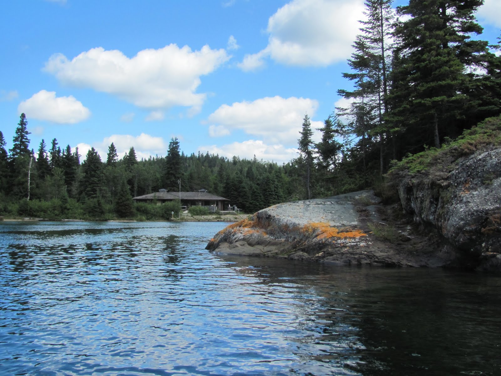
One of the nicest anchorages in the North Channel, and one of our personal favorites, is Bear Drop Harbor.
The tall pink granite rocks line virtually all sides of the harbor, for maximum protection from wind in all directions.
After a brief passing shower, our neighboring trawler must have had a pot of gold aboard, as she was at the end of a rainbow.
We stayed two nights, serenaded by the whippoorwills.
This allowed us time to explore the area by dinghy.
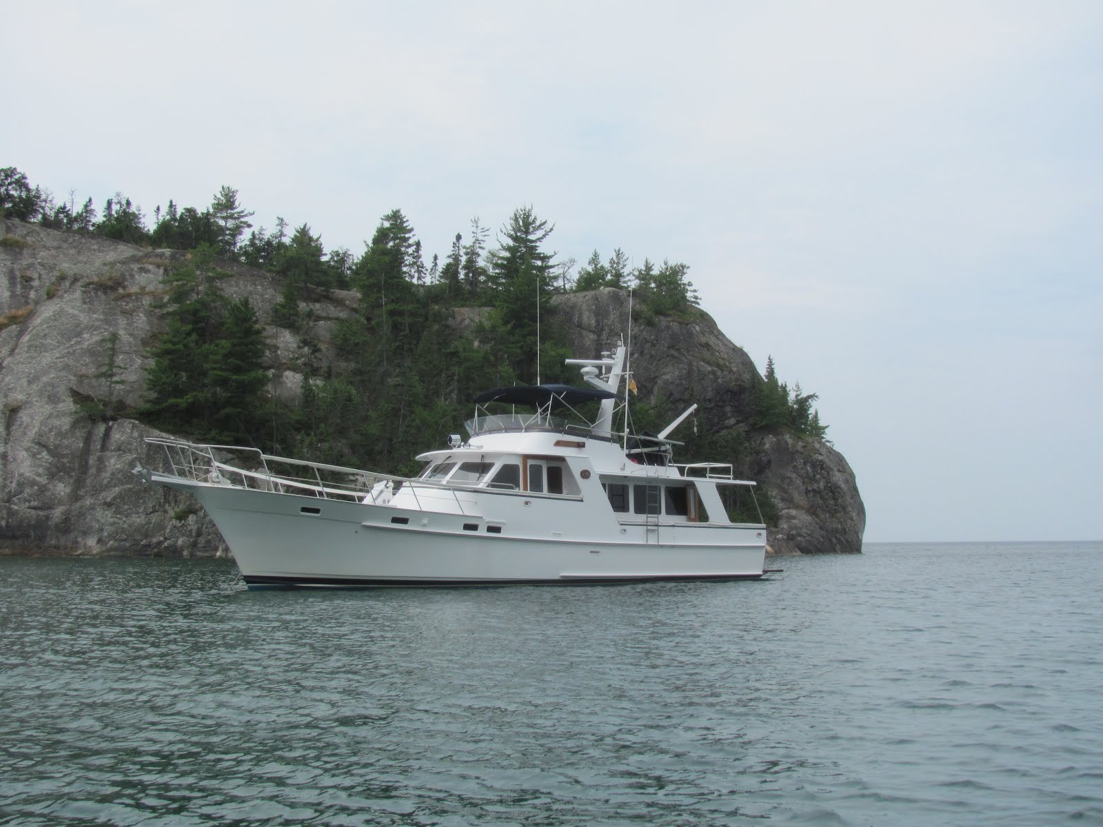
We think the North Channel has some of the most beautiful views in the world.
These views continue at sunup, just before 0600 hours. Neighbors were still sound asleep, but we’ve got a long run to the Straits of Mackinac.
As we exit the North Channel we pass Detour…..
…..and the thousand-foot freighter Burns Harbor, on her way to Superior, Wisconsin, where she’ll pick up a load of taconite ore.
The Detour Passage Light marks this important shipping channel.
We overtake this Cal33 under spinnaker power.
Our harbor for the night is well protected Government Bay, in the Les Cheneaux Islands on the eastern end of Michigan’s Upper Peninsula. We stopped here over 30 years ago on our sailboat Cygnet.
Next morning, we are up early and off to Mackinaw City. Our five neighboring boats were still sleeping.
As we drew abeam of Mackinac Island, the Coast Guard approached and asked us if we had been inspected recently. We showed them our papers from our Memorial Day Weekend inspection on the Hudson River, and that was our “get out of jail free card!” Off they sped to inspect someone else.
As we cruised by Mackinac Island, we saw the Mackinac Island light,
the Round Island Light
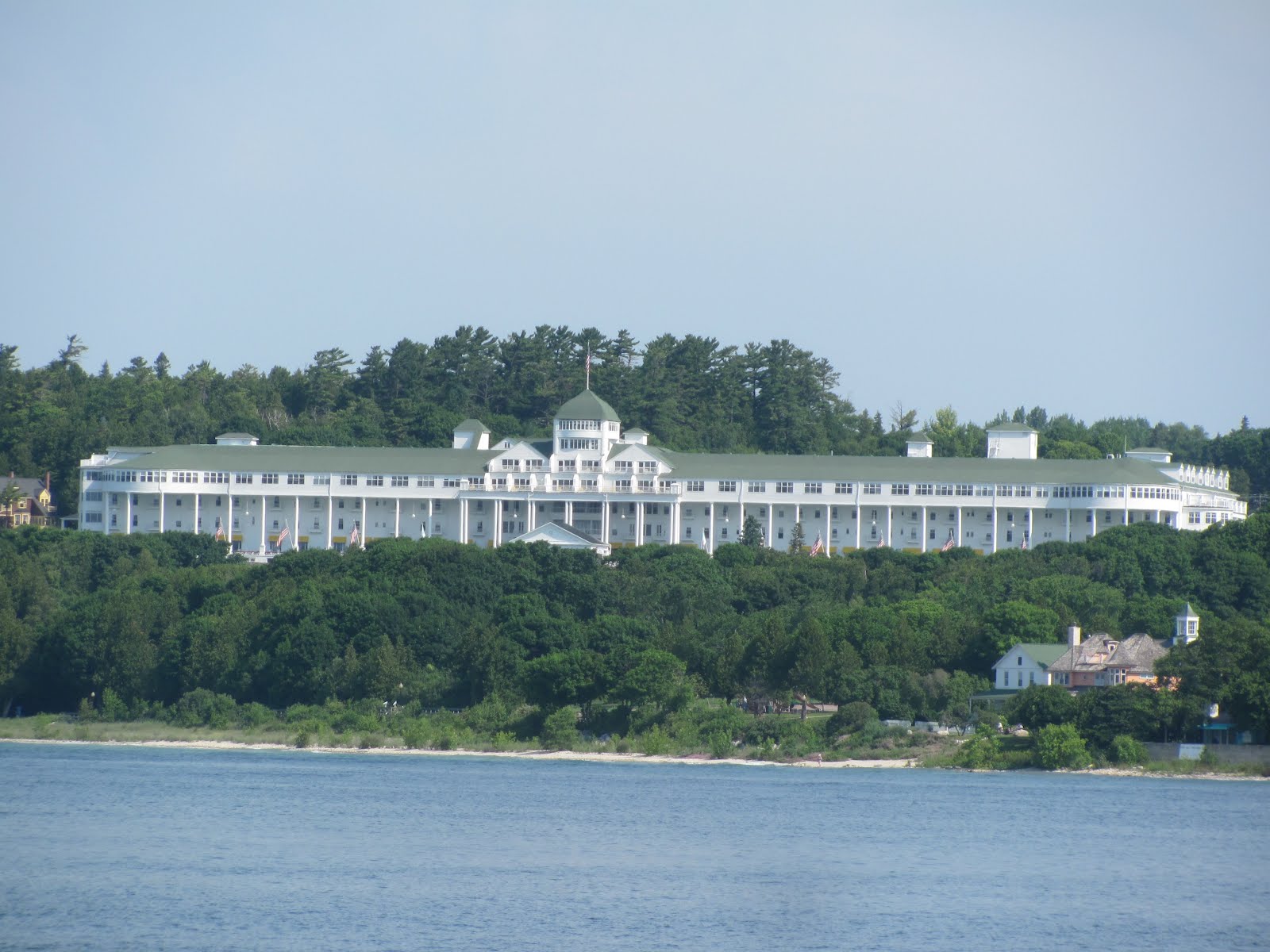
and the iconic Grand Hotel. We’ll be back later in the season for a visit to the island.
We love the Mighty Mackinac Bridge, which seems to be a fitting symbol for the state.
As we approach Mackinaw City, we see the retired Coast Guard Cutter and icebreaker Mackinaw, now a museum. In the harbor here, Monarch will spend about a week, while we visit Marty’s mom and other relatives during the holiday. Stay tuned for further adventures as we head toward Lake Superior.