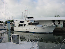
We left Big Bay this morning, and headed offshore and directly for Grand Island, just off Munising. We charted a course just north and east of the island, in order to backtrack past the amazing Pictured Rocks highlighted by the afternoon sun. We were glad we did!

Grand Portal is the prominent point where we began our close-in tour of the Pictured Rocks, designated the country’s first national lakeshore in 1966. You can just make out the hollow area under this formation.

Massive glaciers inched back and forth across this land for a million years, scouring and molding the 500-million-year-old Cambrian sandstone, and pre-Cambrian Jacobsville sandstone.

The Gull Rookery shows the effects of centuries of onslaught by Lake Superior, where battering waves and ice continue to sculpt the cliffs.

Just in front of Jerry is Sail Rock, a triangular rock perched against the shore.

This shows streaks that occur when groundwater drips out of cracks, leaving behind the colorful stain of iron, manganese, limonite, copper and other minerals.

This sculpted profile is called Indian Head.

Lover’s Leap would take care of that broken heart.

At the base of the cliff, you can see the Caves of the Bloody Chiefs

Painted Coves display especially vivid orange and deep rust colors.

Miner’s Castle has a visitor’s overlook accessible by land.

We were glad we took the time to see these in the afternoon sunlight.

Next, past the East Channel Lighthouse and into Murray Bay on Grand Island for the night’s anchorage.
 Grand Portal is the prominent point where we began our close-in tour of the Pictured Rocks, designated the country’s first national lakeshore in 1966. You can just make out the hollow area under this formation.
 Massive glaciers inched back and forth across this land for a million years, scouring and molding the 500-million-year-old Cambrian sandstone, and pre-Cambrian Jacobsville sandstone.
  The Gull Rookery shows the effects of centuries of onslaught by Lake Superior, where battering waves and ice continue to sculpt the cliffs.
 Just in front of Jerry is Sail Rock, a triangular rock perched against the shore.
 This shows streaks that occur when groundwater drips out of cracks, leaving behind the colorful stain of iron, manganese, limonite, copper and other minerals.


No comments:
Post a Comment