 We woke to a sunny, blue 44 degrees. The weather broadcast provided statistics for the past month, and we heard that October had been a very wet month for Tennessee. Twice the average monthly rainfall was recorded, the most for October here in 80 years! In contrast to that, we are glad to see a sunny start to November.
 As we had our coffee, we saw this tow headed upriver, and imagine we will pass it later today, as we are headed the same way.
 Along the river, we see isolated residential areas. This is a pretty cottage, with an in ground pool.
 Several homes here include one that looks like a lighthouse, but is not on the official navigational chart.
 All along the way, homeowners find ways to scale the steep cliffs to get to the water’s edge.
 And then there are beautiful natural areas with no development.
 In many of the small communities we see on the Tennessee River’s banks, the main street ends in a boat launch ramp. Fishing is definitely the local sport!
 Tonight we are in Double Island anchorage. We are safely tucked up out of the traffic line, and enjoy watching it go by. Here is a big barge array. We were interested in a Tennessee River navigational chart notation, which showed “first class landing” and “second class landing.” These are mooring and anchoring areas clearly marked on the charts and by signs on the shores. We thought this was for our use, and liked the idea of “first class” in particular, until we learned these are for the use of the huge tug and barge commercial vessels! So for us they would NOT be “first class!”
 We also saw a few pleasure boaters pass our anchorage. We don’t see many underway, as almost everyone is headed the same direction and going about the same speed as we are. We enjoyed the sunny evening on the foredeck, which quickly melted into a cool night.
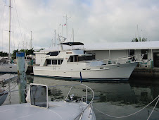
For the latest location info, use this link - http://greatloop.org/mod/aglcalocator/membermap.php?id=1601
No comments:
Post a Comment