 The day was overcast as we made our way the short distance out of Lake Barkley, through Barkley Canal and into Kentucky Lake. This is actually the Tennessee River, which was impounded by the Kentucky Dam in 1944 to create Kentucky Lake. The catalyst for the Kentucky Dam project was the devastating1937 Ohio River Flood. The completion of the dam by the Tennessee Valley Authority (TVA) provided flood control and hydroelectric power, and of course, displaced some communities.
At this point, Kentucky is on both sides of the lake. For all of you who travel to Florida on I-75 through Kentucky, this area of the state is about 225 miles west of that highway. We are in the narrow “pointy” end of Kentucky, where, from north to south, the state is only about 35 miles deep.
 Once in our anchorage of Sugar Bay, we dropped the dinghy in and went exploring. It was overcast and cold, but we dressed warmly and we undeterred. The shoreline here is covered with rocks of beige and orange color, which still have sharp, unpolished edges, as the lake is only 65 years old.
 We understand the Kentuckians use clam strips as bait for catfish. Here is the evidence!
 This area is a National Recreation Area, with unimproved (no electricity or running water) campsites and boat launch ramps. We see many fishermen in go-fast bass boats hurrying to the places where the fish are biting (they hope!).
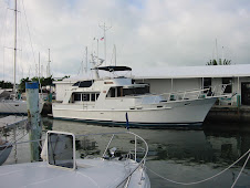
 We settled in for the night. New friends Liz and Steve anchored their Mainship, Shingebiss, in this cove, and we convened on their boat for a chart briefing session. They are headed for southwestern Florida for the first time, and we showed them some of our favorite anchorages in that area.
Here is the link to see where Sugar Bay is - http://greatloop.org/mod/aglcalocator/membermap.php?id=1601
Remember, you can use the Looper Log to see all of our locations
No comments:
Post a Comment