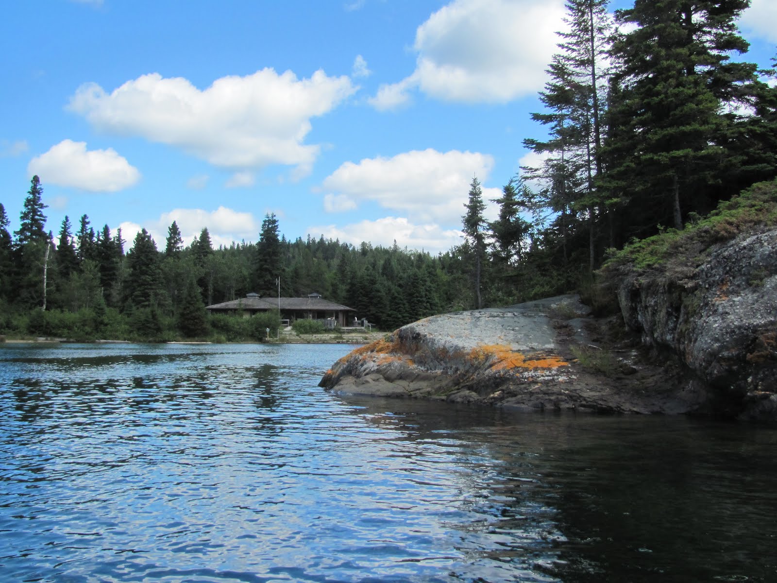
We are enthralled with the anchorages on the north shore of Lake Superior, so many to choose from and so little time! So today it’s onward to Otter Cove, an almost landlocked harbor framed by majestic bluffs, reminding us of a fjord. The cliffs towered 300 feet above this 60-foot high sailboat mast, our only neighbor for the night.
This area is part of the expansive Pukaskwa National Park. Only an abandoned shack and a little-used park warden’s cabin – complete with the pictured outhouse, are in this three-mile deep harbor. We proceeded as far into the cove as we could, anchoring across from a waterfall.
We could hear the waterfall, but even in the dinghy could not see it, as the creek was well hidden by a dense growth of trees.
The forest barely showed this tiny cabin right on the creek. Perhaps they got their running water from the hidden waterfall.
A dinghy excursion took us several miles to see Otter Island, just off Otter Head, the point that cradled Otter Cove. On the island’s north end is another harbor, called Old Dave’s, complete with an abandoned fishing camp in disrepair. This is the harbor that services the Otter Island Lighthouse, now automated. A herd of threatened (and shy, we didn’t see any) Woodland Caribou resides on this island.
Darting across to the mainland, we cruise by beautiful Cascade Falls that plunges directly into Lake Superior.
Back aboard Monarch, we weigh anchor and cruise north through the heart of Pukaskwa National Park. Established in 1983, the park encompasses some 725 square miles of incredible scenery. The rugged shoreline along the coast is stunning, with striated rock formations of contrasting colors.
In the heart of the park, we anchor in Pulpwood Harbor, aptly named for the time when logging was at its peak and 30” diameter log booms were chained or cabled together to corral smaller pulpwood for water transport. We can still see wire cables left behind on the shore. The entrance to our secluded anchorage was scarily narrow, bisected by this tiny island, and yet more than 30 feet deep! The sunset was spectacular.
In the dinghy the next morning, we set out to explore the area. While in our anchorage we were wonderfully secluded, in the next harbor north lies a 67-site campground….
….and Visitor Centre for Pukaskwa Park. This area of the park has hiking trails in easy, moderate and challenging levels (one over 37 miles long one-way), many with stairways and boardwalks to help navigate steep cliffs and wet areas.
This birch lodge is authentic to the Anishinaabe natives, who peopled the north shore of Lake Superior for generations. A First Nation interpreter kindly snapped our photo here.
We hiked several of the trails, including the Southern Headland Trail, which provided breathtaking views of the coast of Lake Superior.
At the top, we gazed out over Superior as we had a picnic lunch.
The path often took advantage of a narrow gap in the rocks.
The Beach Trail took us on Horseshoe Beach, where huge driftwood had been piled up by the prevailing westerlies.
We hiked the just-opened Manito Miikana (Spirit Trail), which had bridges over steep ravines. Here we picked wild blueberries for later use on waffles.
Flights of stairs helped us scale the nearly vertical areas of the trail. We developed quite an appetite from our miles of hiking, and satisfied this with a great meal back aboard Monarch.


No comments:
Post a Comment